


Voting District 1632100000041, Wayne County, Michigan
About
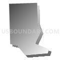
Outline

Summary
| Unique Area Identifier | 600312 |
| Name | Voting District 1632100000041 |
| County | Wayne County |
| State | Michigan |
| Area (square miles) | 0.22 |
| Land Area (square miles) | 0.22 |
| Water Area (square miles) | 0.00 |
| % of Land Area | 100.00 |
| % of Water Area | 0.00 |
| Latitude of the Internal Point | 42.30795460 |
| Longtitude of the Internal Point | -83.27757320 |
Maps


Graphs
Select a template below for downloading or customizing gragh for Voting District 1632100000041, Wayne County, Michigan


Neighbors
Neighoring Voting District (by Name) Neighboring Voting District on the Map
- Voting District 1632100000038, Wayne County, MI
- Voting District 1632100000040, Wayne County, MI
- Voting District 1632100000042, Wayne County, MI